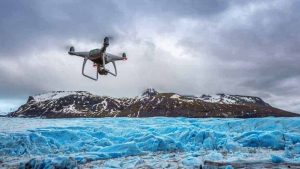
Financial diversity is a good thing. It is akin to not having all your eggs in one basket. Identifying and hopefully doing business in multiple UAV markets is also a good thing. The following industries are in dire need of low-cost aerial photography and are the best sources of immediate income.
The key to prosperous aerial photography is repeat business. It can be fun making money creating a really cool aerial HD video of your buddy’s ranch out in the country for a couple of hundred bucks once. It’s quite another prospect to make a deal scheduling monthly, if not weekly flights, over an ever-changing environment such as construction projects. Let’s step through the top markets and identify their needs for our UAVs.
Real Estate
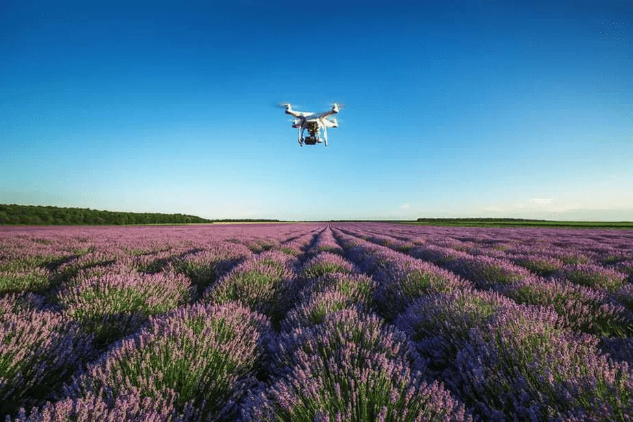
Real estate is the easiest industry to handle when you’re dealing with properties more than five acres in size, and it can offer the most repeat work. Think about it: When you pull up to a suburban property for sale you see probably 90 percent of the front yard. Then go into the house, step out the back door to see the backyard, and you have seen pretty much the whole property. Residential plots with acreage need a more comprehensive presentation. This is especially true when we look at rural properties such as family farms, rural weekend retreats, and full-fledged ranches.
House and Acreage Riding down the road pointing at fence lines, walking through trails, or taking a ride on a Polaris Ranger around the property line can be very enjoyable, but that takes time and effort. It is also difficult to grasp the overall coverage of the property by just driving or walking around. You can use an aerial tour to help grab the attention of the browsing potential buyer and to close the deal on the estate.
Do not waste your time offering your aerial services on urban or even small suburban lots of fewer than 10,000 square feet. Focus your marketing efforts on at least 5-acre properties that are for sale. The larger the better, since the need for aerial photography grows with every acre. It will be nearly mandatory soon for any rural property more than 50 acres for sale to have a production-level aerial HD video with scores of high-resolution pictures. The sweet spot will be rural properties from 10 to 100 acres, since they comprise the majority of farm and ranch parcels for sale.
There are numerous consumer-based real estate websites to find sales leads. These Internet gold mines are MLS-like websites such as our TXLS.com here in Texas. I choose the central Texas area on the search tool and pick all rural properties for sale that are 10 to 100 acres in size. From those hits, I make a spreadsheet of the locations and realtors selling those properties, which makes up my sales call list. As long as my price is competitive, the agent’s response is usually positive.
Construction Projects
Construction General Contractors (GCs) are all about status reports and visual presentations to the clients for which they are building infrastructure. GCs have regular meetings with their customers in a continuous effort to keep them informed, advise them on progress, and explain delays. Having up-to-date views of substantial construction projects in a visually pleasing, aerial format can give them the “warm and fuzzies”; they can see that all is proceeding as planned.
Construction Site Your production-level aerial HD videos also enable these GCs to have excellent marketing material for future bids and sale presentations. That is why the construction industry is an awesome market that is just now getting tapped. One good way to find construction prospects is to drive around and look for vacant lots or demolition sites with large signs displaying that a contractor is about to break ground and start work.
Timing is critical on projects like these, so jump on them and be the first drone in the air. The potential for repeat, consistent aerial projects is tremendous in the construction market. Nail your first project with smooth videos showing the building process in HD video coupled with time and date-stamped, high-resolution aerial photos of the construction stages over time, and you will likely be in demand for future projects.
Agricultural Services
Numerous drone articles have stated how the most lucrative UAV market will be the monitoring and managing of agriculture with drones as flying crop monitors. UAV technology is already extensively in use all over Japan since they have limited land resources and have to be extremely efficient in all agricultural projects. At least 10,000 drones are in flight daily over Japanese farms armed with infrared cameras sampling temperature and moisture and taking photographs to feed into sophisticated software.
This enables farmers to have round-the-clock metrics on the health of their crops. Markets like this are just emerging, hard to enter, and require substantial investment in both UAV platforms and software applications to handle all the complex data.
Fixed-wing drones are more likely to be used in this market due to the massive size of the areas that must be flown and mapped. However, smaller operations could be serviced by simple quadcopters like the Phantom. Location can complicate if there are no crop-producing farms within an hour of your residence. My county primarily raises only cattle and hay, with little consumable crops such as corn, cotton, and barley being produced.
But, I’m already making contacts in surrounding counties that are crop-producing environments so I will know their future agricultural aerial needs. That way, I can now prepare to invest in long-range UAVs, specialized cameras, and agribusiness software platforms to meet the demand.
Two-dimensional (2D) and Three-dimensional (3D) Aerial Mapping
Websites like maps.google.com and applications such as Google Earth are wonderful for viewing the vacation locations you plan to visit this summer. The downside of these aerial image sites is that the resolution is not great and the images are usually over a year old. Your Phantom UAV can change all that for your clients by providing a high-resolution two-dimensional map and today’s content.
For example, say your construction client has done months of work on a five-acre site and wants to show a high-resolution before-and-after image to a customer. You can fly a 90-degree straight shot down in a simple grid, taking several dozen aerial photos, stitching them together as one large image, and present them with an overhead that mimics Google Earth but is from that very day.
Other clients may need some sort of 2D map aerial measurements regularly to help them inventory large areas of gravel, coal, or other masses of stock. Some low-cost software solutions are available for UAV companies, enabling you to measure large entities from the air.
Aerial Mapping
The next step in both complexity and profit is 3D mapping. The same grid flying pattern and even the same low-cost bird can be used, but the images are fed into a much more comprehensive software package to compute not only X and Y but Z to calculate the volume. So with 3D mapping capabilities, the drone company can provide the area estimates of a flat surface area and the volume of those inventory piles by calculating the height or depth.
This 3D aerial mapping software gets expensive fast with monthly rental rates at several hundred dollars. Expectations also increase due to the critical precision of those calculations. Issues such as accurate ground reference points and absolute point cloud positioning (GPS exact within one centimeter) become mandatory. Another name for this aerial market is photogrammetry, which is at the top of the UAV industry food chain.
Event Aerials
If you ever get a call to aerial photograph an event such as a cross-country race or the demolition derby, be forewarned that these UAV gigs are both high-risk and high profile. Due to the possibility of a high density of people, presence of law enforcement, fixed time for the event, and other things moving around, numerous difficulties and challenges are introduced into the aerial photography project. Event Photography The golden rule is not to fly directly over people; this can be tricky when they are scattered around and your shot is near or around them.
Your Landing Zones (LZs) can quickly get overrun and you may need to have crowd control helpers and a spotter. Make sure you understand the challenges of a large amount of onlookers, even in outdoor wedding events. It only takes one drunk guy to mess with you during a critical part of your flight, or some privacy rights activist claiming your drone has violated her just as you are landing. Event Photography The golden rule is not to fly directly over people; this can be tricky when they are scattered around and your shot is near or around them.
Vehicle Dealerships
Car, boat, and RV dealerships are businesses that need our aerial expertise for two reasons. First, we can help them make some really neat commercials with our UAV HD videos, and they will pay handsomely for just a five-second fly-back, rising up by the American flag over the new car inventory scene.
Car Dealership: Some of the bigger RV dealers have huge inventories; the large vehicles take up dozens of acres of parking lots. Our drones can be flown every month simply to provide them with an aerial inventory either in a video format or just a datestamped high-resolution aerial photo.
Inspection Services
Think of all the cell phone towers you see driving down the highway on the way to work. Each one of those structures needs periodic inspections by some poor worker who has to climb and eyeball the towers for any abnormalities. UAV-assisted inspection services are being taken off because they nearly eliminate tower climbing risks.
The same goes for water towers and span bridges since they need yearly, quarterly, or monthly inspections. Contact local engineers, cell tower owners, and area utilities to see if they can use regularly scheduled aerial videos and photos of their infrastructure to find faults before climbers are deployed.
The next time you hear a hailstorm, it may sound like an opportunity calling your name. Some insurance companies are seriously considering using drones to provide high-resolution photos to aid in roof inspections. The larger the roof, the bigger the need for aerial inspection services, which are made affordable by small UAV quadcopters.

Emergency Services
If you are willing to fly at a moment’s notice, then check out the possibility of offering your UAV services to Law Enforcement (LE) agencies and the rescue units for local fire and emergency services. Examples of LE drone needs span from searching large plots of land for illegal pot growing operations to accident documentation flights, to SWAT aerial surveillance missions.
The ability to arrive on the scene and launch your drone within an hour can net you serious billable flight hours.
During my market research pro bono flights, I had the opportunity to participate in a field scan for reported marijuana grow field in central Texas. We had to covertly enter, pick a hidden landing zone (LZ), and then quietly take off. From there we scanned at 200 to 300 foot elevations to avoid shotgun range looking for tents, water hoses, and the actual plants.
The main thing I learned on that mission was to have at least a one-mile range with high-definition First Person View (FPV) in real time. With our Phantom 2 Vision Plus that was just not enough. But with the new Phantom 3’s 1.5-mile range and full HD real-time viewing on the iPad via Lightbridge Communications, we think we should be able to find some cartel grows on our next operation.
After a significant investment in an infrared (IR) camera, feeding to an FPV live display for emergency rescue professionals can make you the hero of the month if you are able to aid in the finding of a lost child from his or her heat signature at 100 feet. The FAA has been quite responsive to special permits for UAV searches for lost persons in emergency situations.
On the Way to Set up a Law Enforcement Drone Flight Both LE and fire rescue units may discuss and even purchase UAVs, but it would take a capitalist to keep the drone ready to fly when that emergency call arrives. If you can make that commitment and close a sale for a fixed price fee, your monthly income would be supplemented and you would have some interesting aerial adventures.
UAV Market Summary
When discovering which markets you will target, start out with simple real estate projects and define your craft from there. After you have a handle on the whole process, from making the cold call to closing the sale and cashing the check from the successful UAV project completion, then utilize those newly acquired business and technical skills to conquer another market. Use each market as a building block to the next one to achieve income source diversity.